Learn About LA’s Communities Using the LA Times New Neighborhood Map
Ever wanted to know more about your neighbors, but were afraid to ask?
Well, the LA Times has asked about your neighbors for you — and mapped out the answers with its neighborhood mapping project.
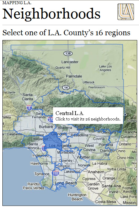
Through a joint effort, the Los Angeles Times and its readers have mapped L.A., providing individual maps and statistics for approximately 158 cities and 114 neighborhoods within the city.
The Times’ neighborhood maps offer information regarding income, education, schools, age, population, and ethnicity, along with up-to-date news from each selected area. You can click on a region to see the neighborhoods available, and then click on any one to view a more detailed map.
As an example, the maps show considerable differences among education levels. In the San Marino neighborhood of the San Gabriel Valley, 70 percent of residents age 25 and older have a four-year college degree, while in the nearby South El Monte neighborhood, that number is a drastically lower 3 percent.
This new mapping tool may well become a valuable resource for Los Angeles-area neighborhoods. Do you know of similar projects statewide where media organizations have mapped their community?
Tags: Data Projects
Posted by kidsdata.org
This entry was posted on Thursday, July 8th, 2010 at 7:05 pm. You can follow any responses to this entry through the RSS 2.0 feed. You can leave a response, or trackback from your own site.


